Install the SAGA GIS plugin⚓
Description⚓
SAGA GIS (System for Automated Geoscientific Analyses) is an open-source Geographic Information System (GIS) software used for geoscientific analyses and spatial data processing. It offers a wide range of tools for terrain analysis, hydrology, geomorphometry, and image processing. SAGA GIS especially processes raster dataset.
This plugin allows you to run SAGA GIS toolboxes in QGIS.
Procédure : How to install SAGA GIS plugin in QGIS ?⚓
Install the plugin
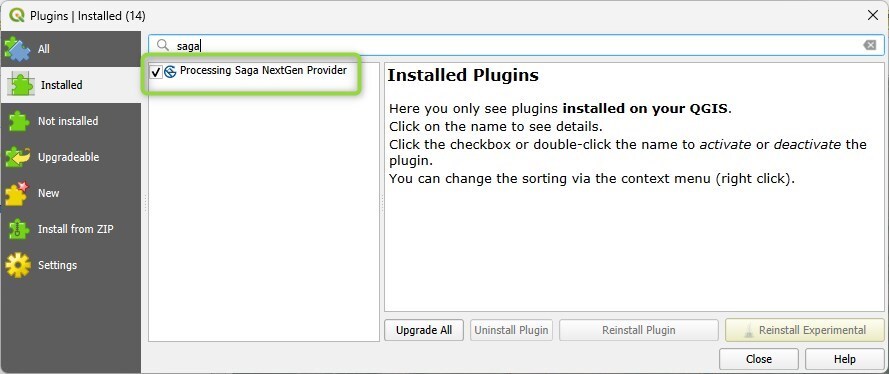
Open the
Plugins / Manage and install pluginsmenuSearch the
Processing SAGA NextGen Providerplugin and install it.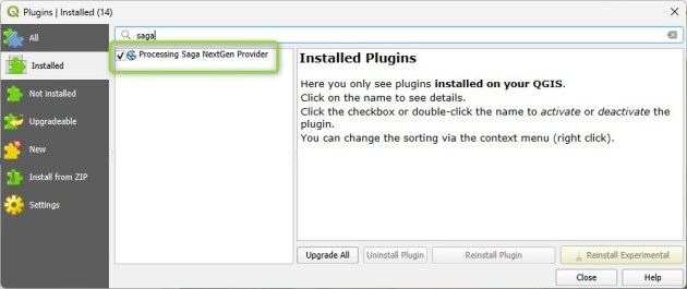
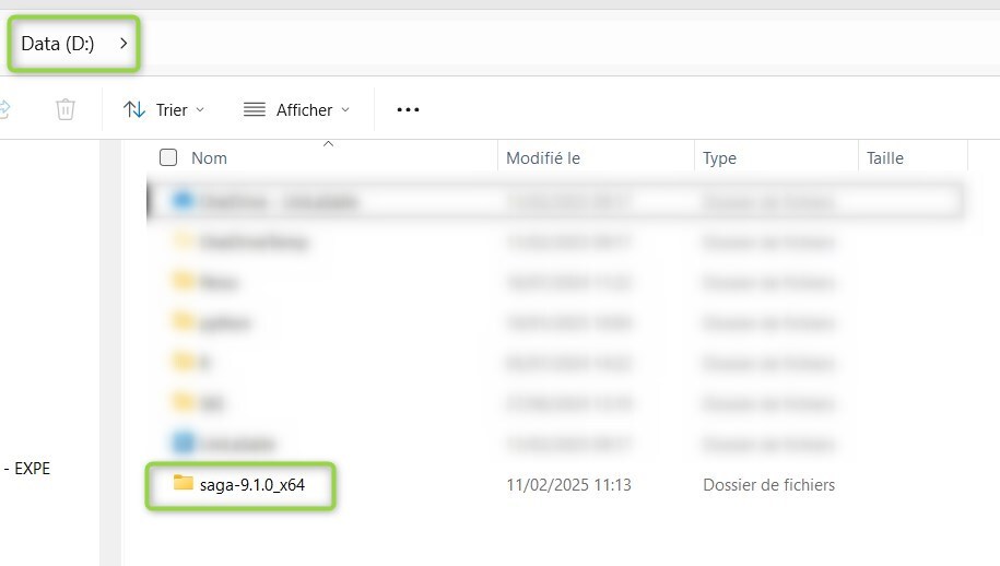
Donwload the SAGA GIS files
The plugin does not contain the toolboxes. They should be downloaded from the SAGA GIS website.
Install the SAGA GIS files on your computer
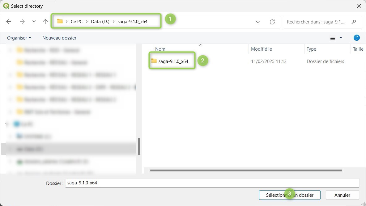
Unzip the SAGA GIS file (saga-9.1.0_x64) and put the SAGA GIS folder in a specific location (D :/ drive, for example).

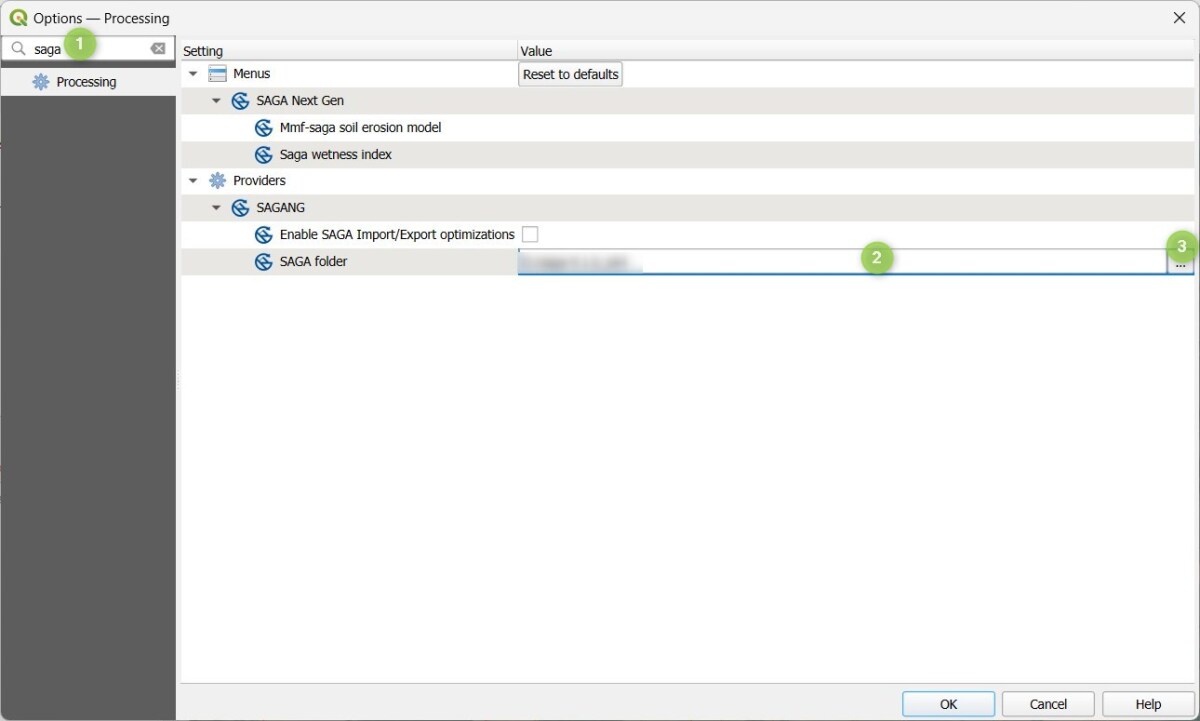
Give QGIS the location of the SAGA GIS files
Open the
Settings / OptionsLook for
SAGAin the search barDouble-clik on the line
Click the
...button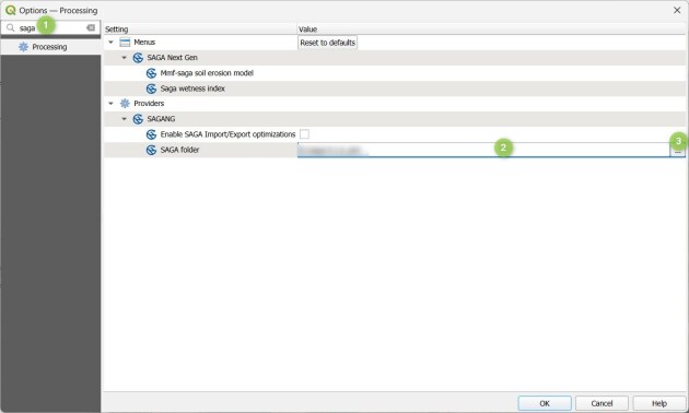
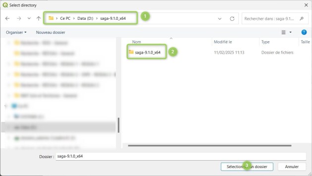
Remark : it is highly probable that there are 2
saga-9.1.0_x64folders.Move to the D :/ drive and enter the
saga-9.1.0_x64folderSelect the
saga-9.1.0_x64folderValidate
- Résultat
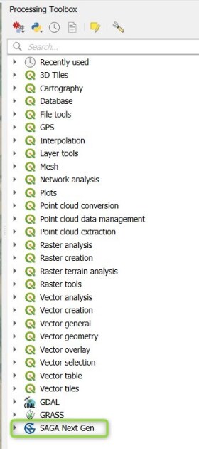
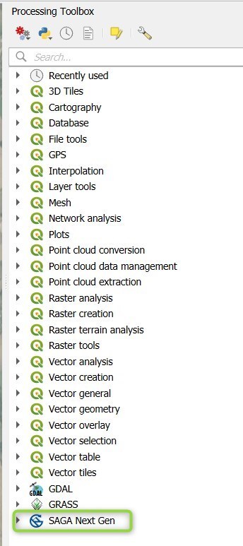
Expected result⚓
The SAGA GIS toolboxes are available in the
Processing Toolboxpanel.